Property Description:
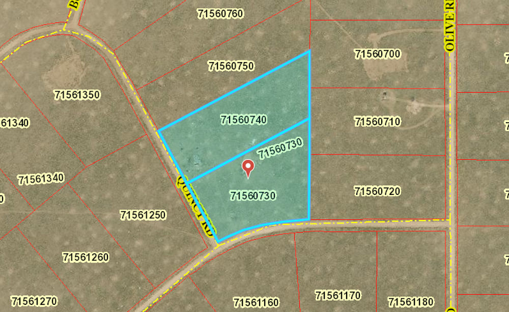
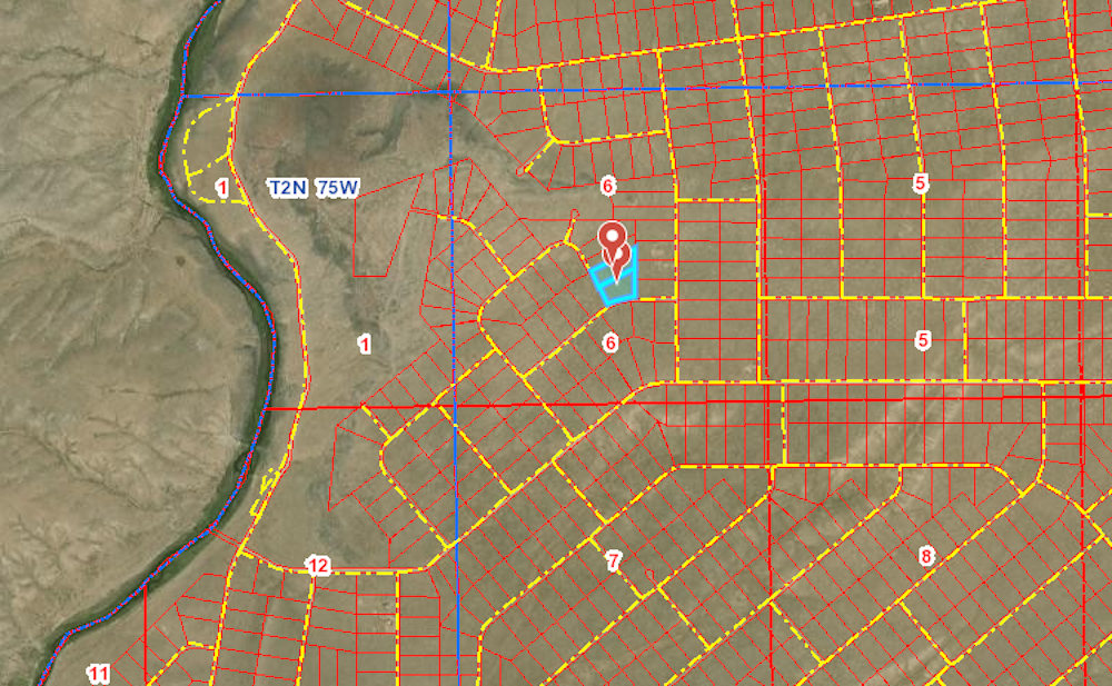
10 sprawling acres – Camp, hunt, fish, and hike, whenever you want, just minutes to the Rio Grande River! You could Pull up in your RV or truck and spend some time unwinding and enjoying the great outdoors. Bring the ATV, dirt bike, or side-by-side and have some fun. This property is two adjacent 5 acre parcels zoned for single family homes. On this land you can build a (two) homes/cabins, mobile homes, park RV’s and simply use for recreation like camping! Enjoy your relaxing and welcoming land just 3 miles to CO-142, 20 miles to San Luis and only 30 miles to Alamosa with easy access to a Super Walmart, restaurants & more.
Costilla County is in the San Luis Valley which is a broad, relatively flat valley at the headwaters of the Rio Grande in south central Colorado and north-central New Mexico. The valley is about 50 miles across and about 150 miles from north to south. It is bounded on the east by the Sangre de Cristo Mountains and on the west by the San Juan Mountains. Rio Grande Ranchos offers a moderate cost of living, perfect conditions for solar energy, and is an agricultural workhorse. Although there is little surface water, it sits on top of the largest, cleanest water table in the North American Continent. A variety of crops are grown here thanks to the sun shining an average of 300 days per year and the aquifers that lie beneath the San Luis Valley floor.
Attractions in the area include but are certainly not limited to:
• Rio Grande National Forest
• The Sand Dunes Swimming Pool Hot Spring
• Great Sand Dunes National Park and Preserve
• Cano’s Castle, Antonito Colorado
• San Luis State Park
• The bronze sculptures by Huberto Maestas depicting the Stations of the Cross
• Penitente Canyon
• The Arts in both San Luis and Taos, New Mexico
What are you waiting for? Get this before someone else does!
Property Location:
Parcel 71560730
GPS Coordinates:
37.159700, -105.712300
Approximate Corners:
37.160000, -105.712600 – NW
37.160900, -105.710600 – NE
37.159600, -105.710600 – SE
37.159300, -105.712100 – SW
Google Map Link: https://goo.gl/maps/omqCz8ek6vw7EJcJ6
Parcel 71560740
GPS Coordinates:
37.160400, -105.712800
Approximate Corners:
37.160700, -105.713100 – NW
37.161800, -105.710600 – NE
37.160900, -105.710600 – SE
37.160000, -105.712600 -SW
Google Map Link: https://goo.gl/maps/z1f3FqhBL9UPvpWU9
The Facts:
PARCEL #: 71560730
County: Costilla, CO
Property Description: R.G.R. UNIT 48 BLK 22 LOT 15
Size: 5 Acres
Elevation: 7,516 ft
Taxes: Approximately $48.72 per year
PARCEL #: 71560740
County: Costilla, CO
Property Description: R.G.R. UNIT 48 BLK 22 LOT 16
Size: 5 Acres
Elevation: 7,516 ft
Taxes: Approximately $48.72 per year
Access to property: Yes, Quincy Rd & Paul Rd
Road surface/type: Dirt
Who maintains roads? County
Closest highways: CO-142
Closest major city: Alamosa, CO (30 mi)
Closest small town: Mesita, CO (10.5 mi)
Closest gas station: Lee’s Texaco Store, 217 Main, Antonito, CO (16.4 mi)
Zoning: Vacant Estate Residential (ER)
Site built homes – 600 sqft minimum footprint.
Camping is allowed on the property – 14 days every 3 months (longer permit available)
RVs are allowed on the property – 14 days every 3 months (longer permit available)
Mobile homes are allowed on property: must be 1976 or newer
Water: would be by Well or holding tank
Sewer: would be by Septic
Utilities: Alternative Energy (Solar, wind, or generator)
Costilla County Planning & Zoning office is open Monday through Thursday and can be contacted at (719) 672-9109 to answer any questions.
Please see our page on Costilla County for more information this on area.
To invest in this property now, select the “Reserve Now” button above.
You can also call us at 800-401-3199 or email sales@freedomlandgroup.com


